
/cdn.vox-cdn.com/uploads/chorus_asset/file/24016885/STK093_Google_04.jpg)


/cdn.vox-cdn.com/uploads/chorus_asset/file/24808816/Starfield__The_Settled_Systems___Supra_Et_Ultra_____Starfield__The_Settled_Systems___Supra_Et_Ultra_2023_7_25_94252.263_1440p_streamshot.png)


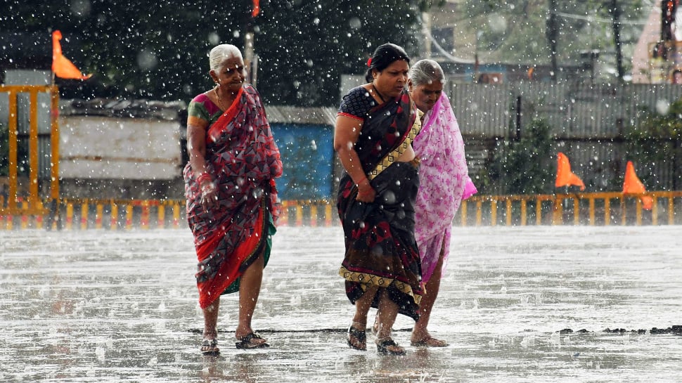

New Delhi: The India Meteorological Department (IMD) on Tuesday said that there is a slight delay in the onset of southwest monsoon over Kerala and it is likely to make its onset by June 4. However, scientists said the delay is unlikely to impact kharif sowing and overall rainfall in the country. The southwest monsoon normally enters Kerala on 1 June with a standard deviation of about 7 days.
“This year, there is a slight delay in the onset of southwest monsoon over Kerala. Monsoon onset over Kerala is likely to be on June 4 with a model error of 4 days.” The Met Office said in a statement,
However, private forecasting agency Skymet Weather said the monsoon is likely to hit Kerala on June 7 with an error margin of three days.
It said in a statement, “The onset will be delayed and the progress in peninsular India will be a bit sluggish. Warm weather will continue in the central and northern parts of the country in June this year. This may not bode well for kharif sowing.”
Read this also | Mumbaikars will now get weather updates on phones during monsoon
Monsoon arrived in the southern state last year on May 29, 2021, June 3, 2020, June 8 in 2019 and May 29 in 2018.
The IMD said that its forecasts for the onset of monsoon over Kerala have proved correct during the last 18 years except in 2015.
The predicted monsoon onset is within a standard deviation of 7 days. IMD chief M Mohapatra told PTI that this is not likely to affect kharif sowing and overall rainfall in the country.
“There is no one-to-one relationship between the onset date and the total rainfall over the country during the season. Also, early or late arrival of monsoon over Kerala does not mean that it will cover other parts of the country accordingly . The monsoon is characterized by large-scale variability and global, regional and local characteristics.”
M Rajeevan, former secretary of the Union Ministry of Earth Sciences, said it was unlikely that the delay was due to Cyclone Mocha. “Had the cyclone developed around May 20-May 25, it would have actually affected the monsoon. The cyclone (Mocha) has already dissipated.”
“This could be due to insufficient warming in the Indian subcontinent. The progress of the monsoon also depends on other factors such as the phase of the Madden-Julian oscillation and how El Niño is developing,” Rajeevan said.
The Indian monsoon is governed by temperature and pressure differences between the Indian landmass and the Indian Ocean.
During the summer months, the landmass warms, creating an area of low pressure that draws moist air from the ocean, resulting in precipitation.
Large parts of the country, except the eastern and northeastern parts, experienced prolonged rains due to several back-to-back weather systems between April 21 and May 7.
As a result, most parts of the country recorded much lower than normal day temperatures during this period.
Roxy Mathew Cole, a climate scientist at the Pune-based Indian Institute of Tropical Meteorology, said a coastal El Nino has already developed in the eastern Pacific.
“It should develop into a mature state by June-July. This can potentially affect the onset, progress and overall distribution of monsoon rainfall. The onset may be weak or delayed, and IMD’s The onset forecast aligns with that.”
“If the onset of monsoon is delayed and sea conditions are warm, there may be chances of formation of a cyclone near onset. This may change the course of monsoon. This happened with cyclones Nisarga and Tauktai. However, the forecast Do not give signals. It is a cyclone now. We will have to wait and see.
Private forecasting agency Skymet Weather said that a powerful cyclone ‘Fabian’ is moving from the southern peninsula, over the South Indian Ocean in equatorial latitudes.
It said, “The hurricane-strength weather system will take about a week to clear the area. This monstrous storm is restricting equatorial flow and the formation of the monsoon current.”
In addition, the Arabian Sea continues to host an anticyclone over the central parts in the lower levels of the atmosphere. It acts as a deterrent to the smooth flow of monsoon currents from the Arabian Sea to the west coast.
“Other relevant features are also unlikely to align with the desired wind pattern over the next 10 days or so. There are no signs of setting up the typical low-level jet of westerly winds considered essential for the onset of Monsoon ” Said.
The IMD had said last month that despite the development of El Nino conditions, India is expected to receive normal rainfall during the southwest monsoon season.
Skymet Weather predicted “below normal” monsoon rains in the country.
India has already seen four consecutive years of ‘normal’ and ‘above normal’ rainfall during the monsoon season.
Normal rainfall is crucial to India’s agricultural landscape, with 52 per cent of the net cultivated area dependent on it. It is also important for replenishing reservoirs important for drinking water apart from power generation across the country.
Rainfed agriculture accounts for about 40 percent of the country’s total food production, making it a significant contributor to India’s food security and economic stability.
El Nino, a warming of waters in the Pacific Ocean near South America, is usually associated with weakening of monsoon winds and dry weather in India.
El Nino conditions this year follow three consecutive La Nina years. La Nina, which is the opposite of El Nino, usually brings good rainfall during the monsoon season.
The Madden Julian Oscillation (MJO) is a large-scale intraseasonal atmospheric disturbance that originates in tropical Africa and moves eastward. It is like a pulse or wave which lasts for about 30 to 60 days.
During the active phase of the MJO, the atmosphere becomes more favorable for precipitation. This leads to increased cloud cover, stronger winds, and increased convective activity, resulting in heavy rainfall over the Indian subcontinent.
During the inactive phase, cloud cover decreases, winds weaken, and convective activity is suppressed, leading to dry conditions and weak monsoon rainfall.
